Newly-updated cycle maps available
Fri 27th July 2018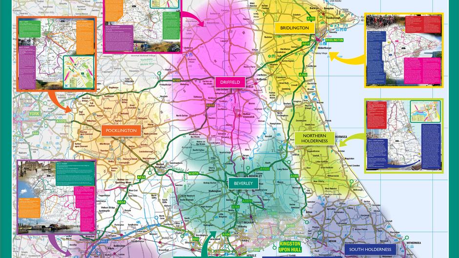
A series of seven cycle maps, which include 41 rides of varying lengths across the East Riding, are now available to download onto smart phones or other compatible devices.
Designed by the council’s transport policy team, the maps can be found on the authority’s website.
The rides can now also be downloaded using simple step-by-step instructions onto Garmin, MemoryMap or SatMap devices. The GPX routes can also be downloaded onto applications for Android or iPhones.
The maps cover the areas of Beverley, Bridlington, Driffield, Goole, North Holderness, Pocklington and South Holderness and include information on the area, facilities for cyclists, such as nearest cycle shops, local tourist attractions to visit and other long distance cycle routes in the area.
The maps have proved very popular with local residents and visitors to the area and have recently been distributed to a range of venues, including caravan sites, B&Bs, cafés, glamping sites, tourist attractions, libraries, tourist information centres and customer service centres.
If you wish to view any of the cycle maps and download the rides, visit www.eastriding.gov.uk/council/plans-and-policies/other-plans-and-policies-information/transport/transport-policy/#walkers-and-cyclists
Paper copies of the maps are also still available by emailing transport.policy@eastriding.gov.uk